UNIVERcity

Location:
Kazakhstan, Astana
Year:
2022
Status:
Designed
Area:
286.5 ha
Work done:
Urban planning
Site plan
Visualization
The team:
Katerina Kovaliova
Pavel Nishchanka
Anton Petrukhin
Yuri Korolev
Elizaveta Lavrinovich
Darya Rogovtsova
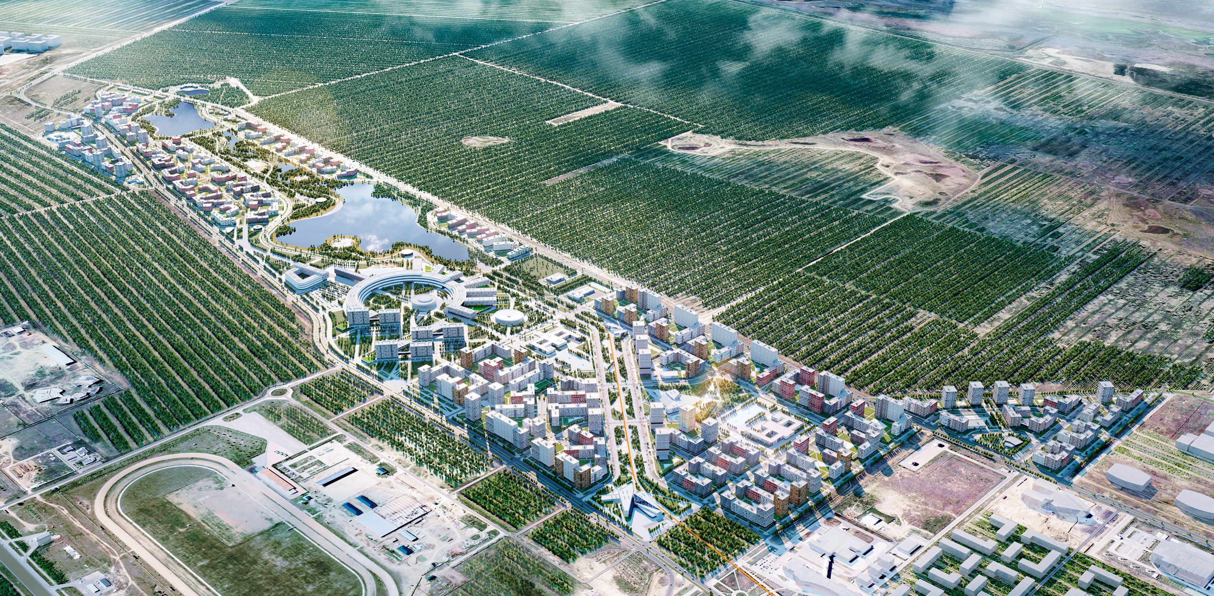
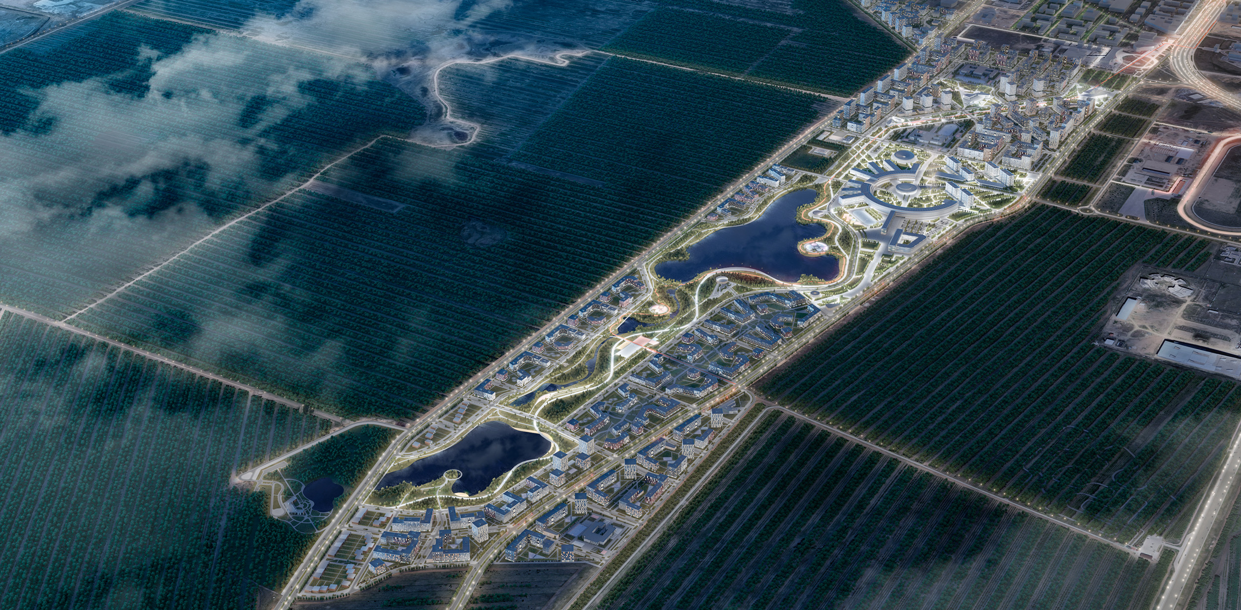
UNIVERcity is the concept of the university campus and the development of a multifunctional residential area in Astana. The design area is located in the southern part of the city at the intersection of two highways. It serves as a link between the city center, and international airport.
Numerous social, cultural, and administrative facilities are adjacent to the design area, which saturates the infrastructure of the future UNIVERcity district: the National Space Center, the Ethno-aul National Cultural Complex, schools, and a horse-racing track.
Campus Site Plan
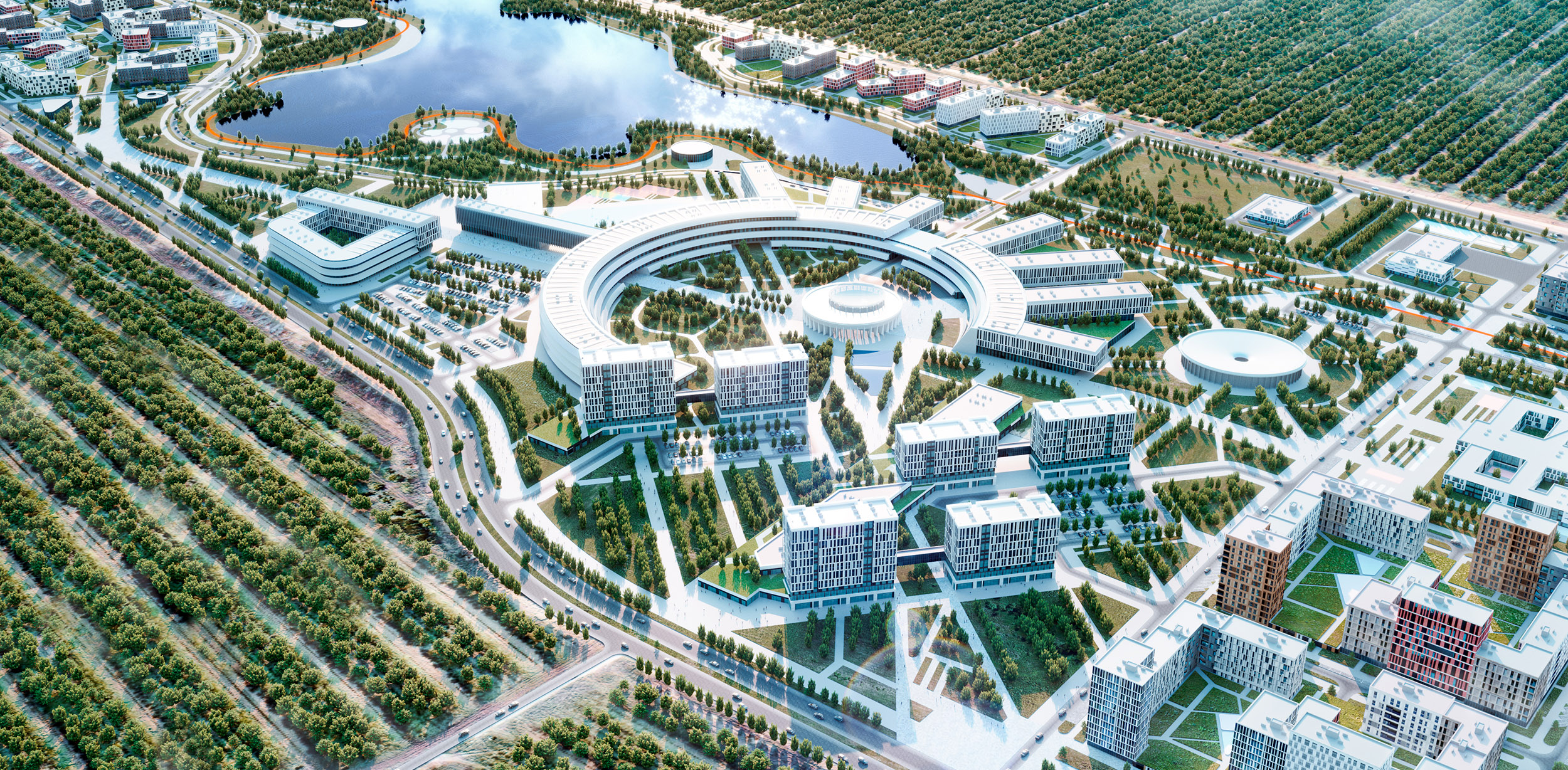
The university site plan represents the shape of a ring, which refers to the classical amphitheater or forum space.
This geometry allows us to unite tons of people in a single place and creates an atmosphere of openness and interchange.
Functional Zoning of the Campus
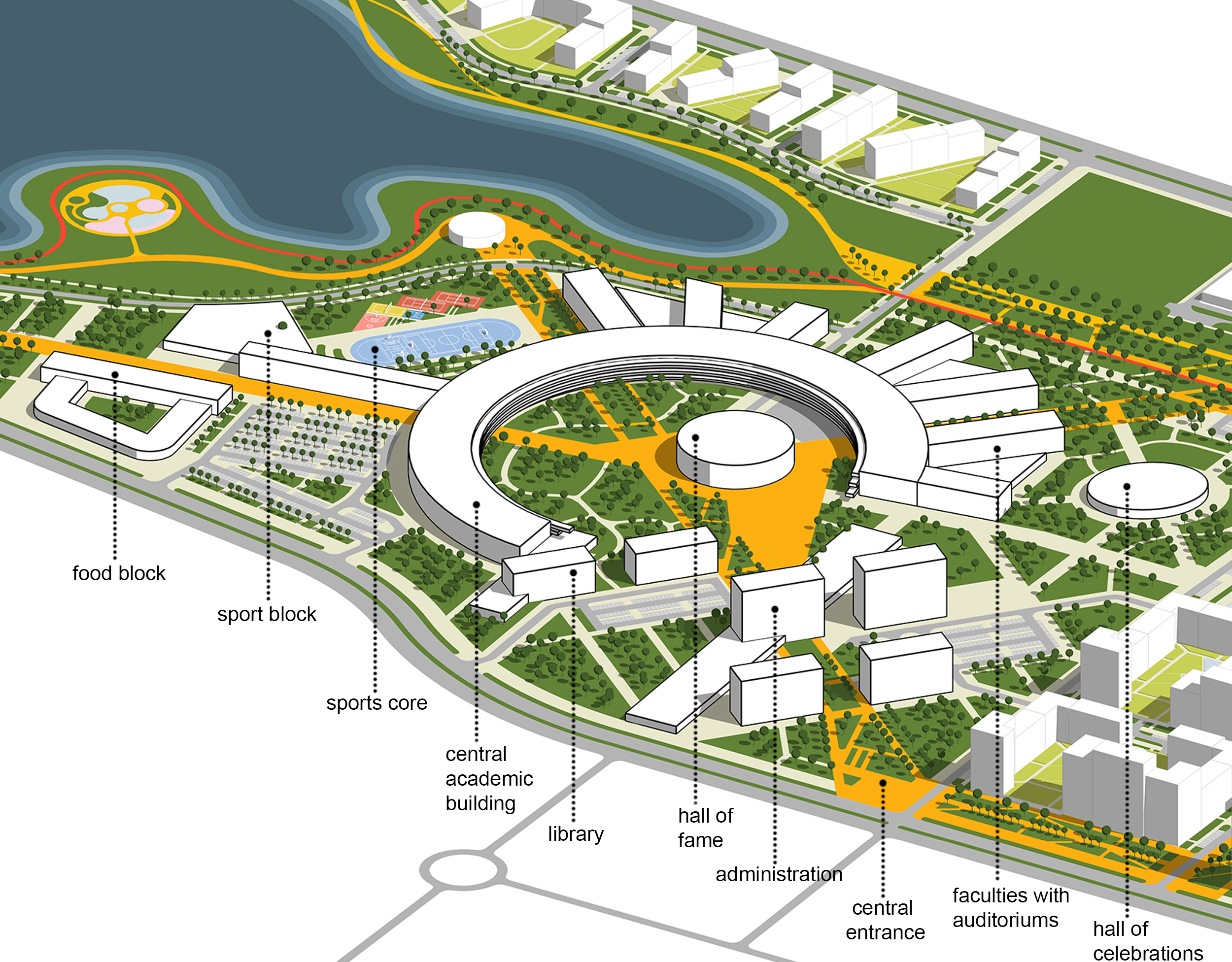
The central academic building occupies the main semicircle, from which the faculty buildings with lecture halls radiate. Inside, there is a Hall of Fame, and a separate volume next to it houses the Hall of Celebrations. A building with a university library is adjacent to the main one. The administrative part is located along the primary pedestrian alley. There is a sports block with outdoor sports grounds on the south side of the semicircle. Nearby, there is a food block.

Principles of territory formation
1. The planning framework of the main streets caters to rational transport service of the territory and communication with the surrounding areas, considering the already built street and road network.
2. The basis of the project is the creation of a new university — the dominant of the district, as well as multifunctional and shopping centers in the northern part of the design area. It is necessary to provide visual corridors for the most comprehensive perception of these buildings from distant points.
3. Several large reservoirs are located in the design area, based on which it is proposed to create a green zone — the heart of the university campus. It is also offered to create a network of green boulevards that will connect all green areas into a single system.
4. Taking into account the planning structure and visual axes, place residential and public development blocks to provide the access to green spaces and transport infrastructure for each block.
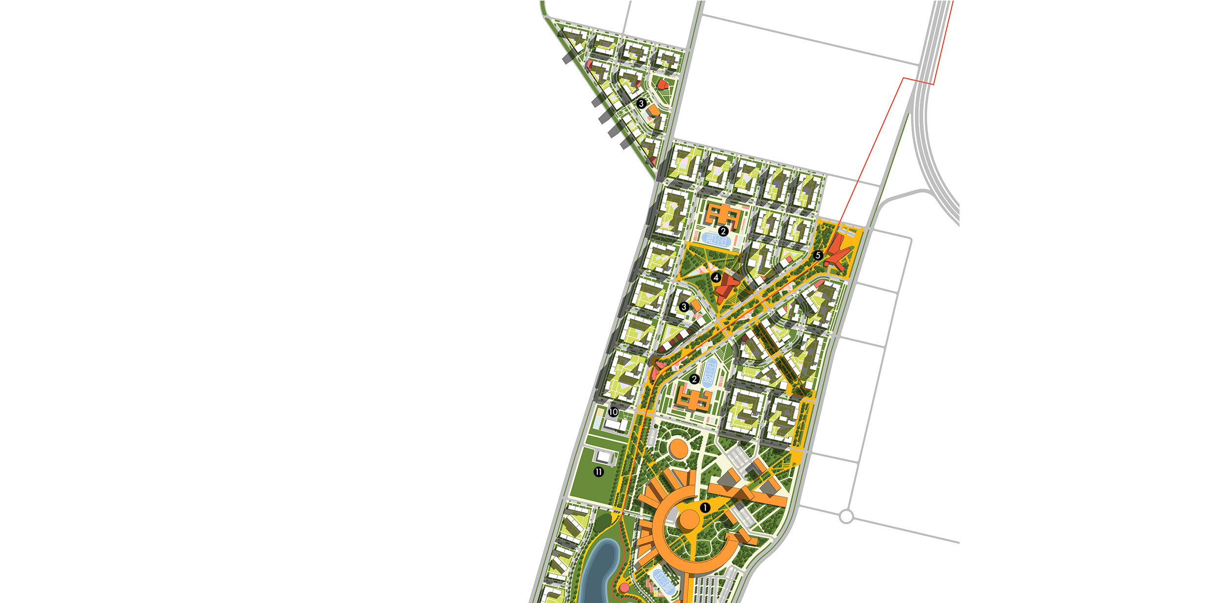
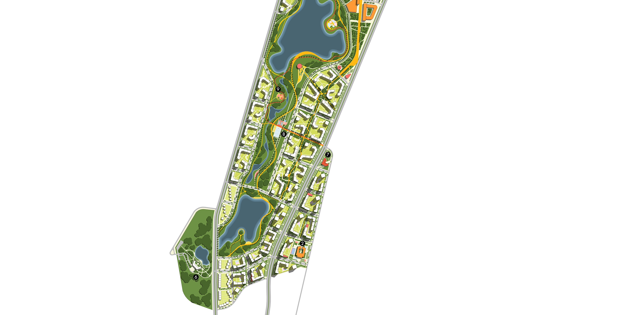
1. University
2. School
3. Kindergarten
4. Multifunctional complex
5. Shopping Center
6. Residence
7. Public Service Center
8. Sports core
9. Playhub
10. Fire station and police station
11. Olimp Substation
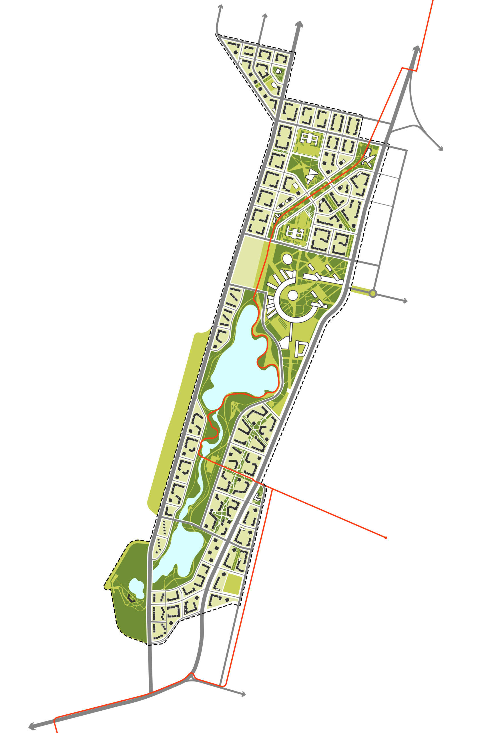
Green Framework
The forest sections of the Astana green belt are directly adjacent to the design area. The area has an elongated shape with natural reservoirs that have the potential for further landscape design. We provide different methods of greening the territory. Our team offers the solution of a large natural park that connects reservoirs. A linear park with playhouses runs between the blocks, and pocket parks are provided for small areas.
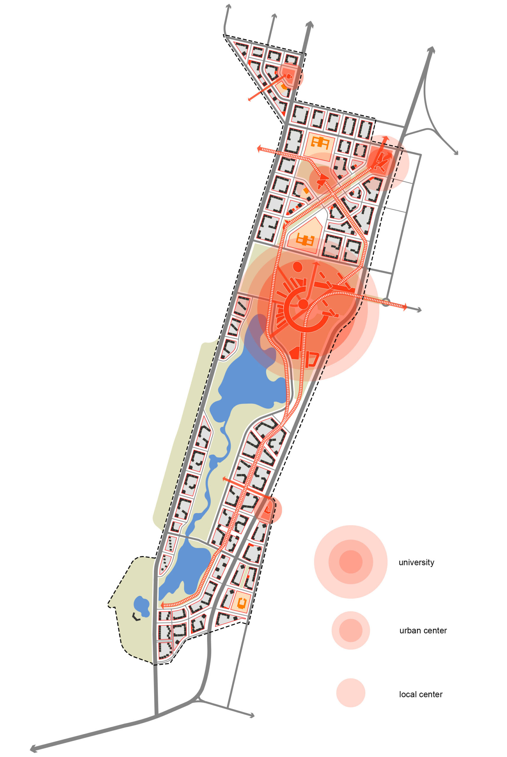
District transport service system
It is planned to create a university with a developed infrastructure in the design area — a global-level infrastructure facility. It is offered to place a city-level object — a shopping and entertainment complex in the northeastern part of the design area, tangentially to Turan Avenue. The project caters to a developed service system, including urban facilities, social infrastructure, public subcentres, and built-in commercial facilities. The infrastructure for the district transport service is located along pedestrian boulevards, which furnishes convenient access for residents without a car. A multifunctional center — a district-level object — is located in the northern part of the area, which will be accessible to all residents of UNIVERcity. Social infrastructure (kindergartens, schools) is also located adjacent to the boulevards, which allows one to create a comfortable and safe environment for residents.
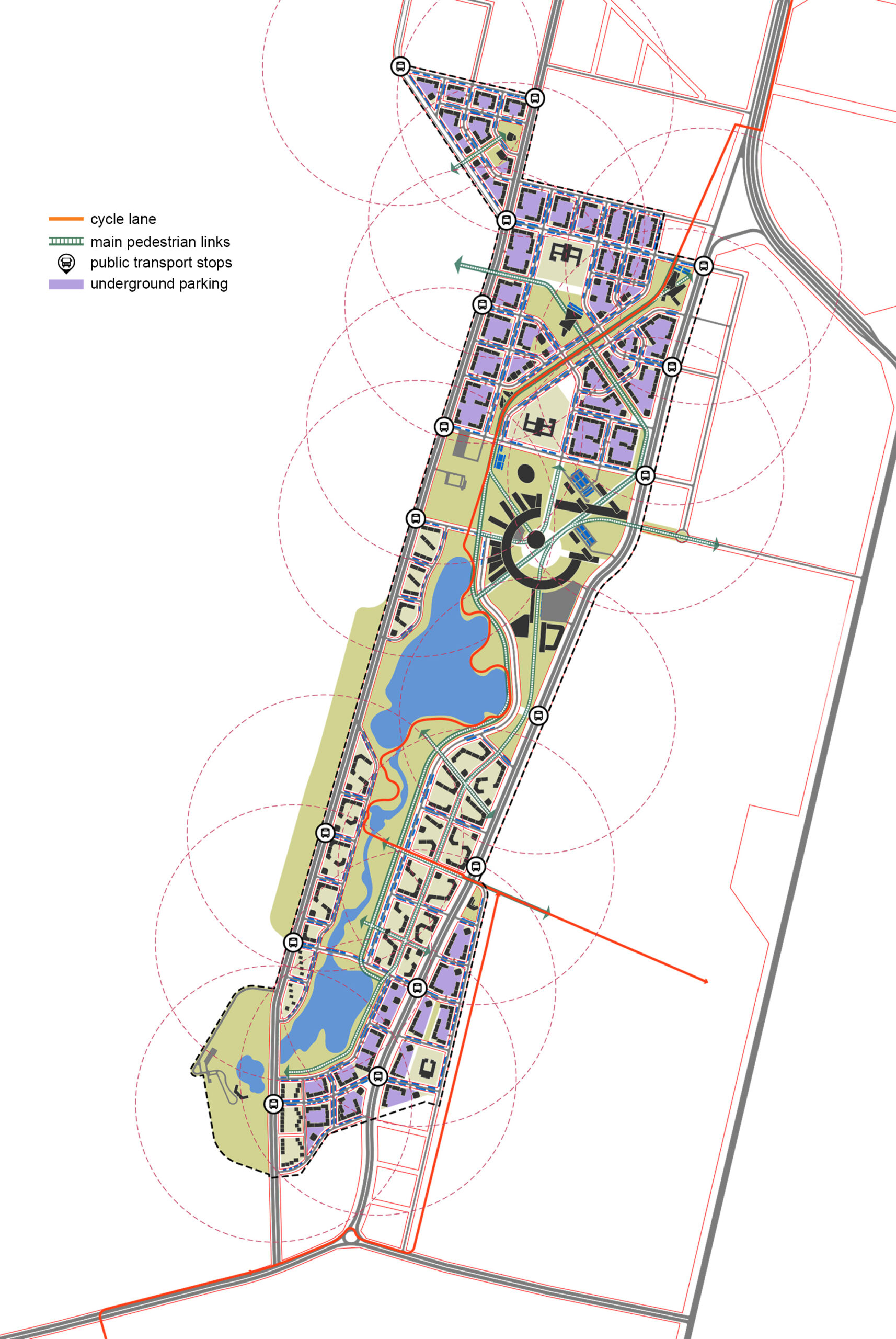
Transport framework
The design area encompasses a well-thought-out transport system, which will effectively service the area and avoid personal transport transit through residential neighborhoods. Pedestrian boulevards and bike paths form a continuous pedestrian-bicycle framework that cohere social facilities, housing, and recreation areas, which ensures their accessibility without motor transport. Public transport is provided along the perimeter streets, which will bring the access to public transportation stops for all residents.
