GREEN LINE
Location:
Kazakhstan, Nur-Sultan
Year:
2021
Status:
Designed
Work done:
Urban Planning
Site plan
Visualization
The team:
Pavel Nishchanka
Katerina Kovaliova
Vlad Chabai
Dmitry Sergienya
Ilya Polonski
Darya Rogovtsova
Pavel Astapienya
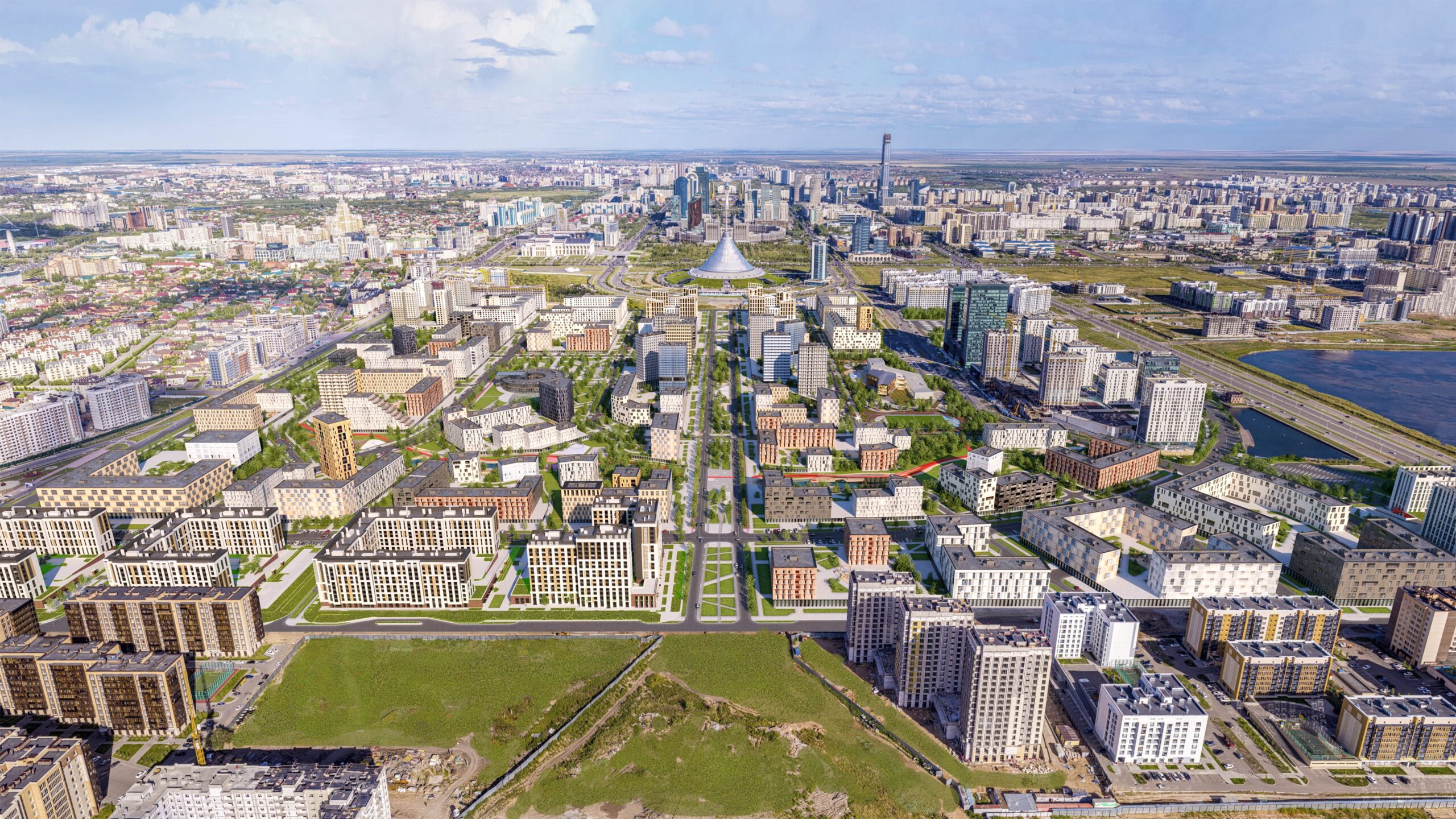
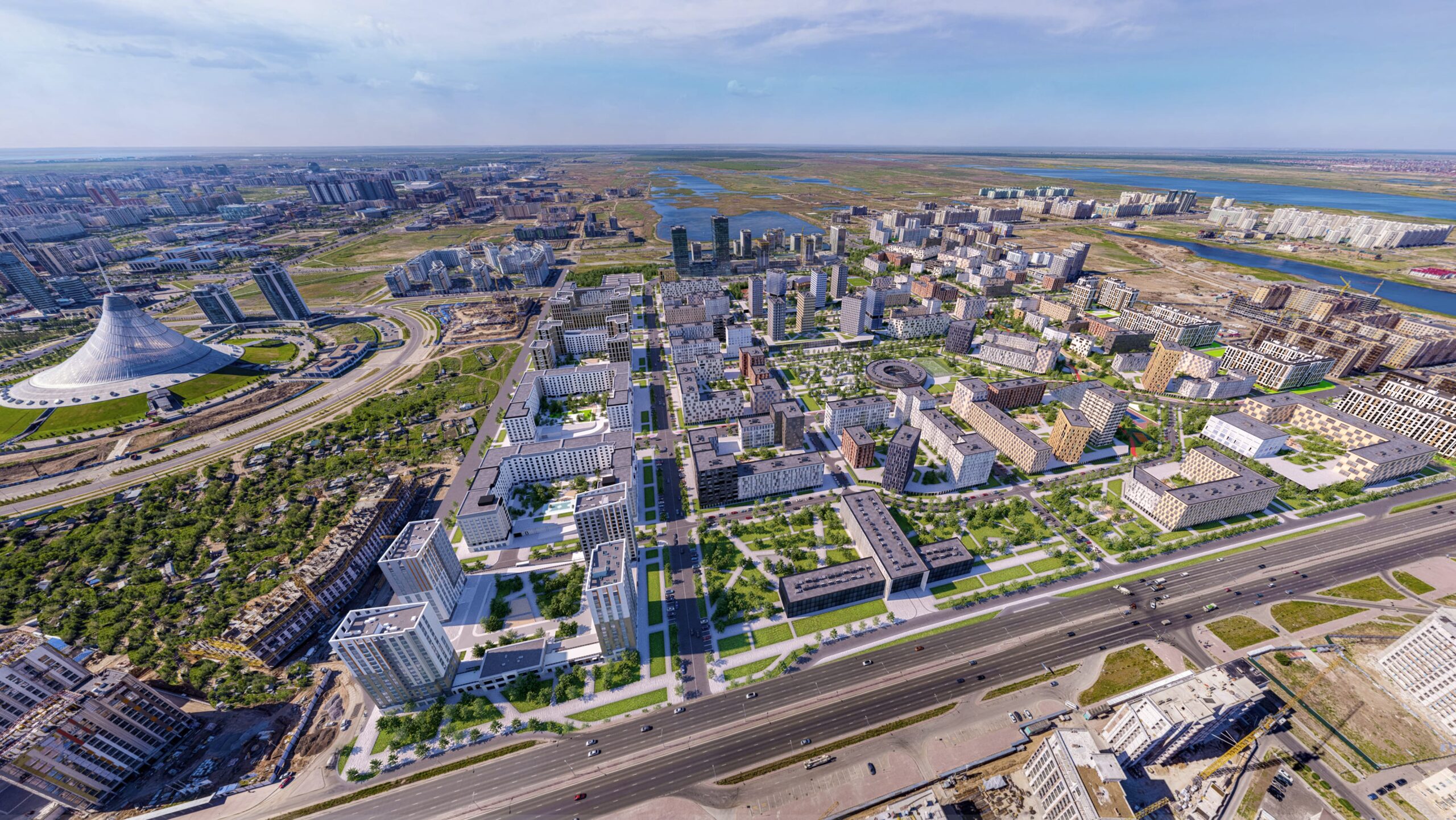
GREEN LINE is an urban planning project for a residential district in Nur-Sultan.
The project aimed to develop a master plan that would improve the previously created detailed layout plan. For the project, our team dramatically reimagined the proposed structure, considering the site’s natural features.
The existing riverbed became the primary planning axis of the district, where we proposed to create a district park and connect it to the central square by diagonal boulevards. Our architects also proposed revising the transport framework and making it more rational.
It allowed us to create a unique residential district and, at the same time, secure the technical and economic indicators of the development stipulated in the detailed plan.
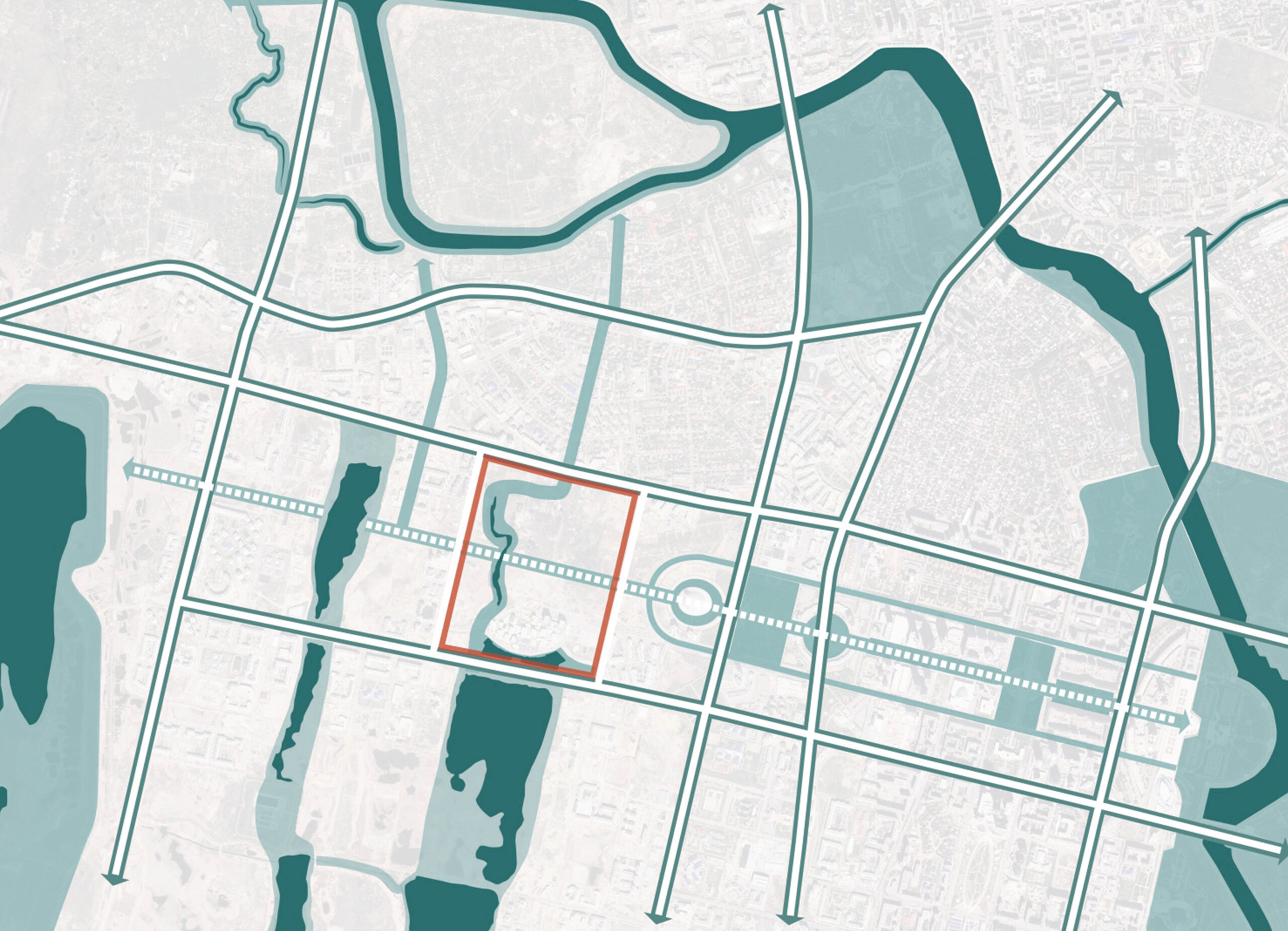
The existing urban context
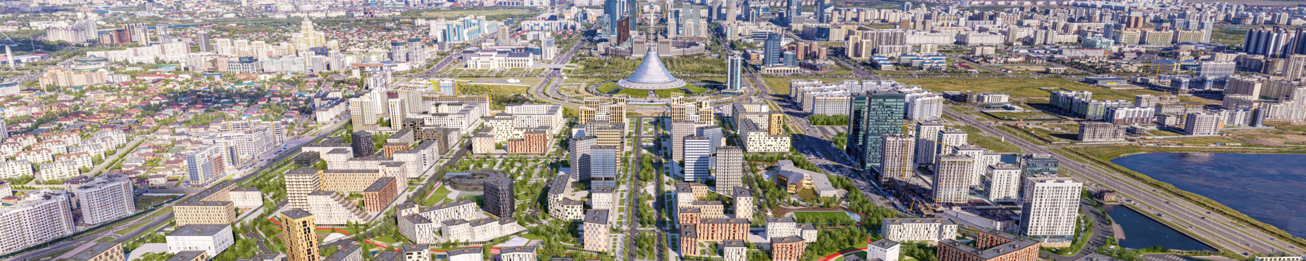
The planning structure of the new part of Nur-Sultan is based on the intersection of two compositional axes. The first is the central axis, where the capital’s primary governmental and public buildings are. In the east, it closes with a new railway station; in the west, it goes to Lake Taldykol and the green belt of Nur-Sultan.
The second axis starts from the city’s center – the Baiterek tower, directs to the south and forms the right angle with the central one.
Abu Dhabi Plaza, the tallest building in Kazakhstan, and the EXPO 2017 International Exhibition Center are oriented on it.
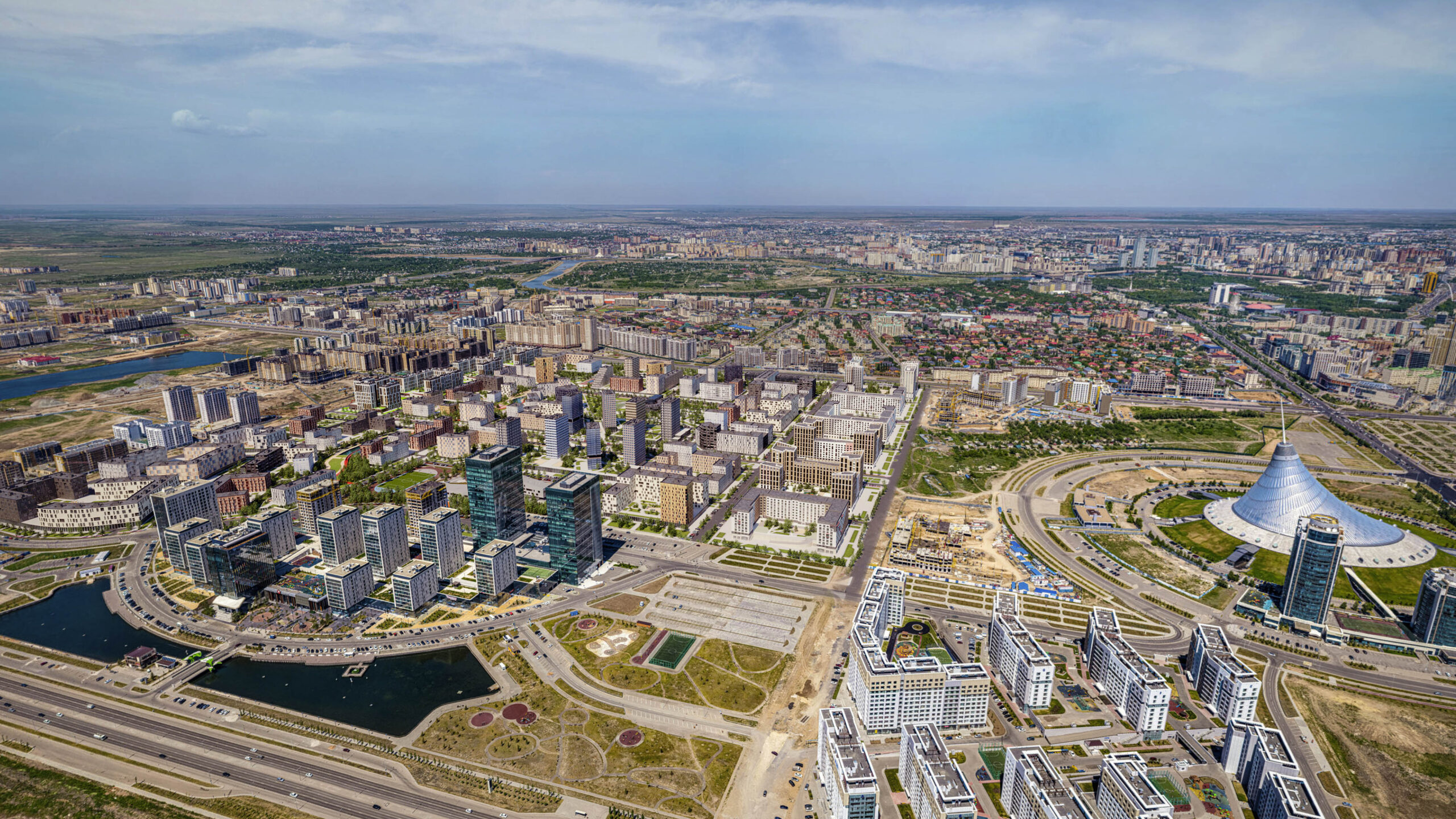
The area of the territory is 111 hectares.
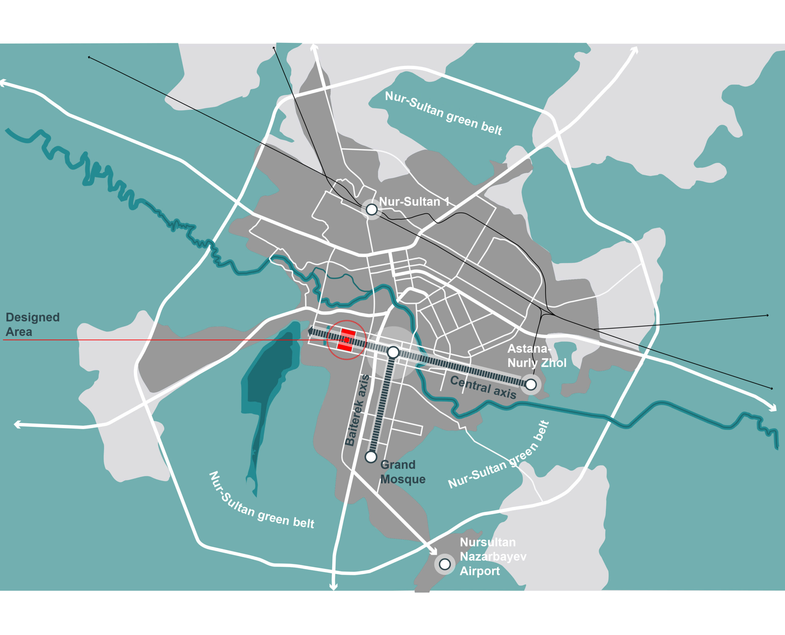
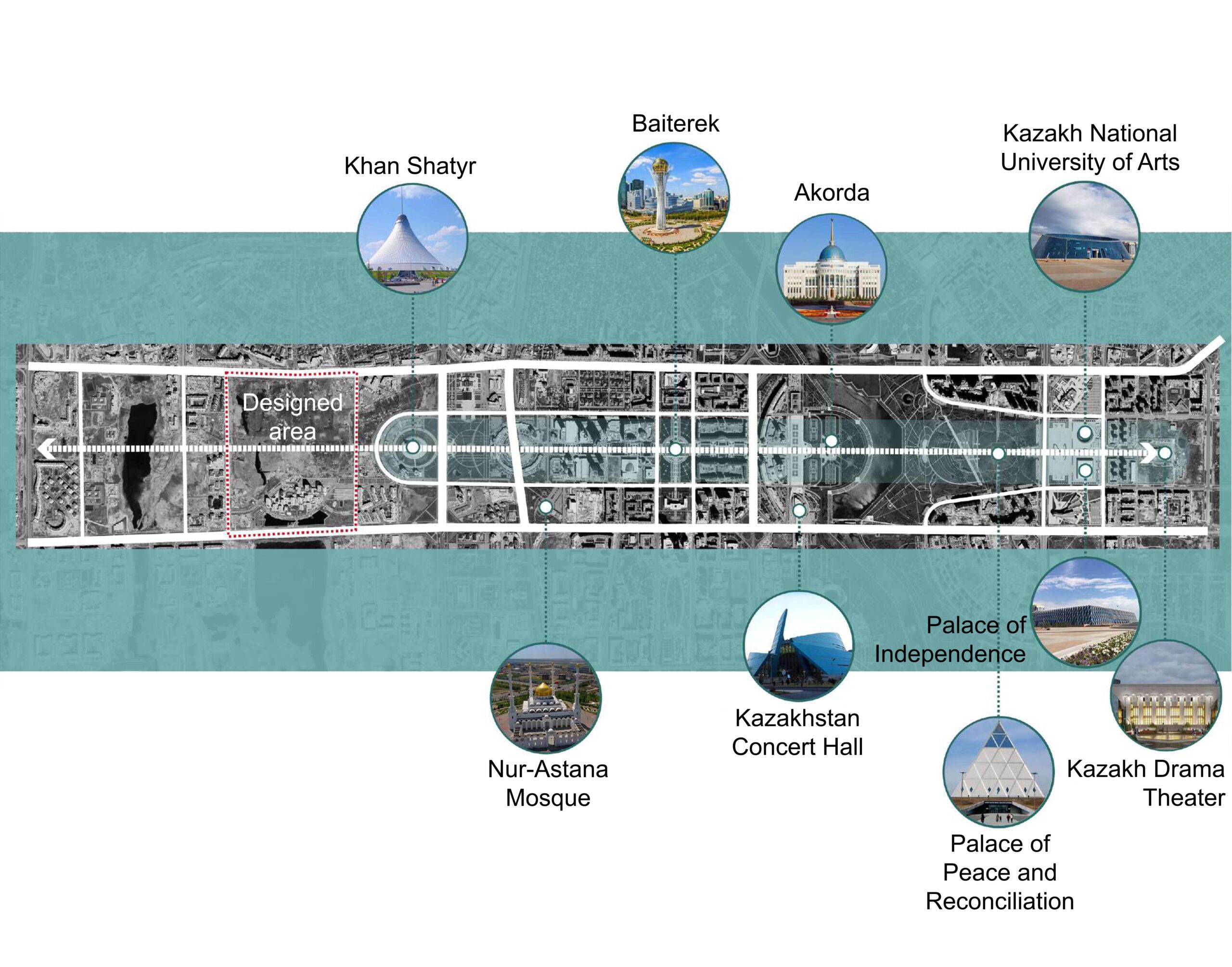
The central planning axis is the ensemble of outstanding buildings, monuments, and parks that form the image of the capital of Kazakhstan.
The location of the design area on the axis continuation subordinates the district to the general compositional solution of the city. Due to this, new unique architectural objects appear.
A green area with a pond passes through the site – this is one of the city’s green framework parts. Including this axis in the planning structure of the district became one of the tasks of our project.
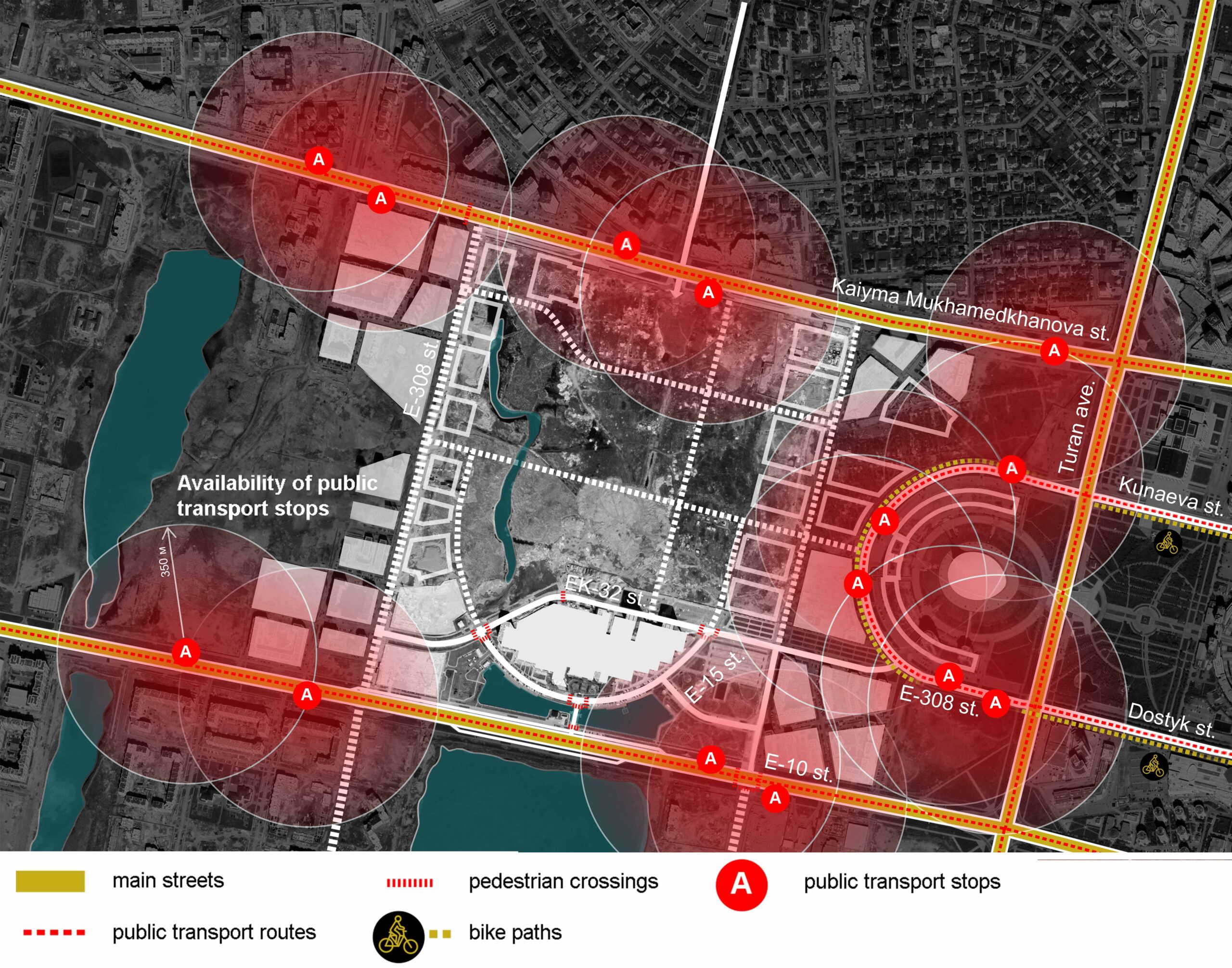
Two main streets serve the territory, where bus routes were designed. The existing public transport service does not cover the entire residential district territory.
In the central part of the city, the first stage of the development of bicycle infrastructure was implemented: the bike lane fringes Khan Shatyr.
The disadvantages of the previously proposed detailed layout plan
The planning structure had some disadvantages, which we eliminated while preserving the basic compositional design:
1. The street-and-road network was subject to the formalistic symmetrical composition without considering functional relevance. It was the cause of inconvenient and dangerous intersections and areas.
2. The project did not consider the existing water objects and natural landscapes.
3. There were no transport-free pedestrian zones.
4. School sites were isolated from residential development by streets.
5. The project provided hypertrophied public space without a functional purpose. And all public spaces were shown schematically.
6. Green zones were being created on the district periphery, which reduced their attractiveness.
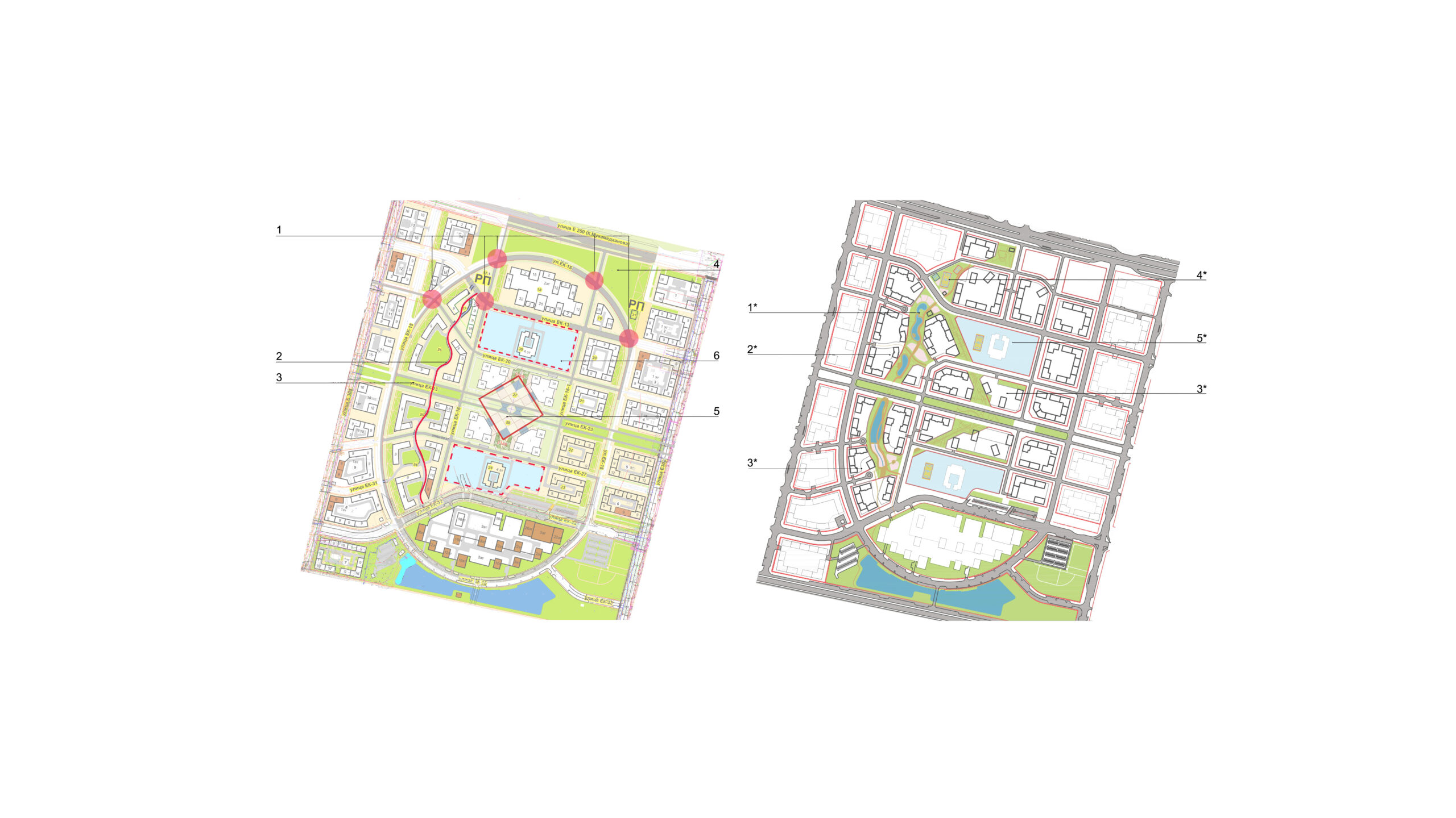
The advantages of the new detailed layout plan
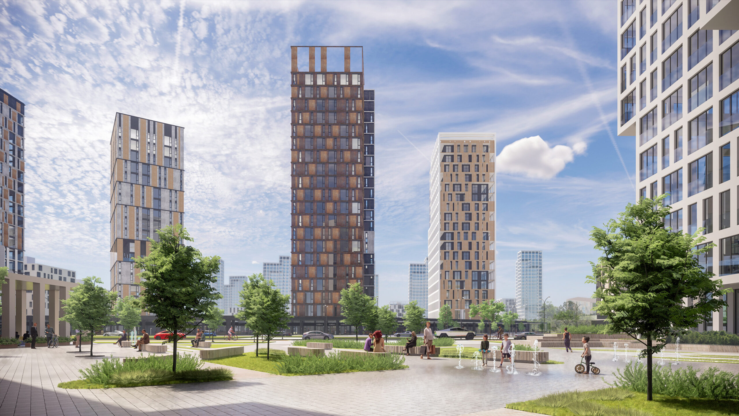
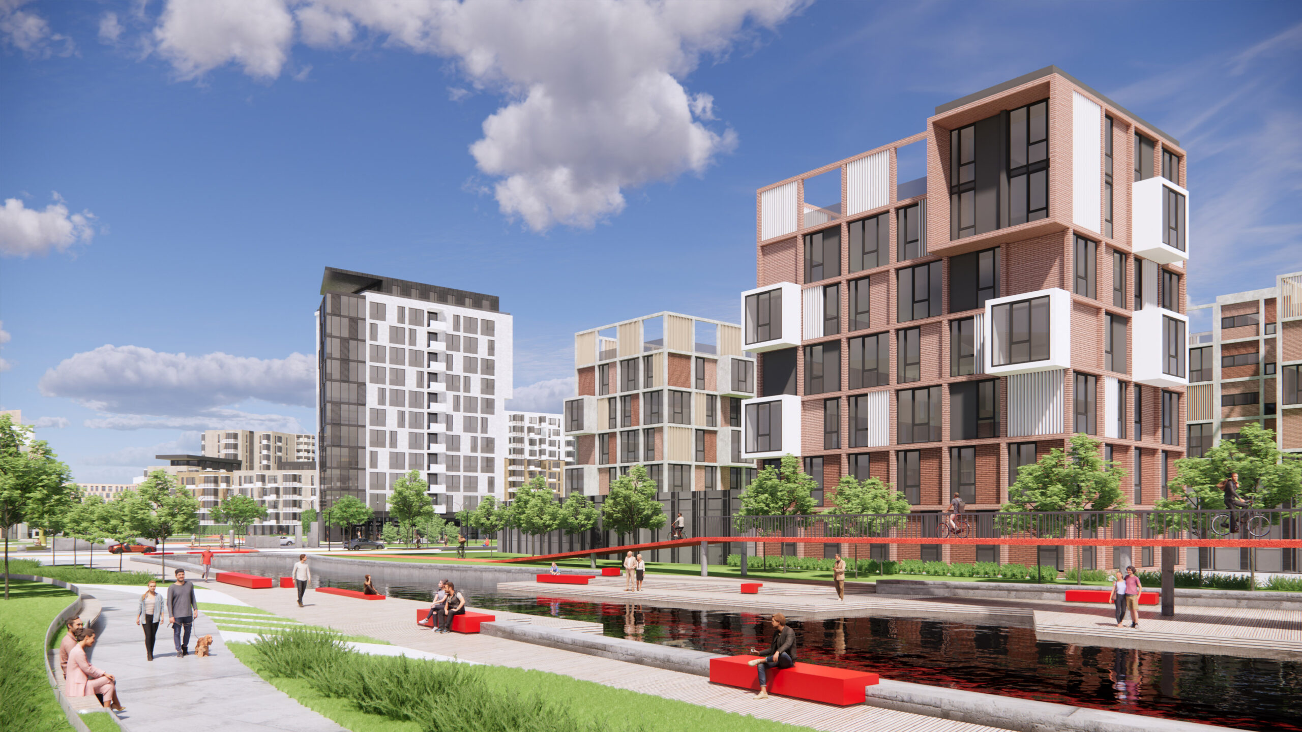
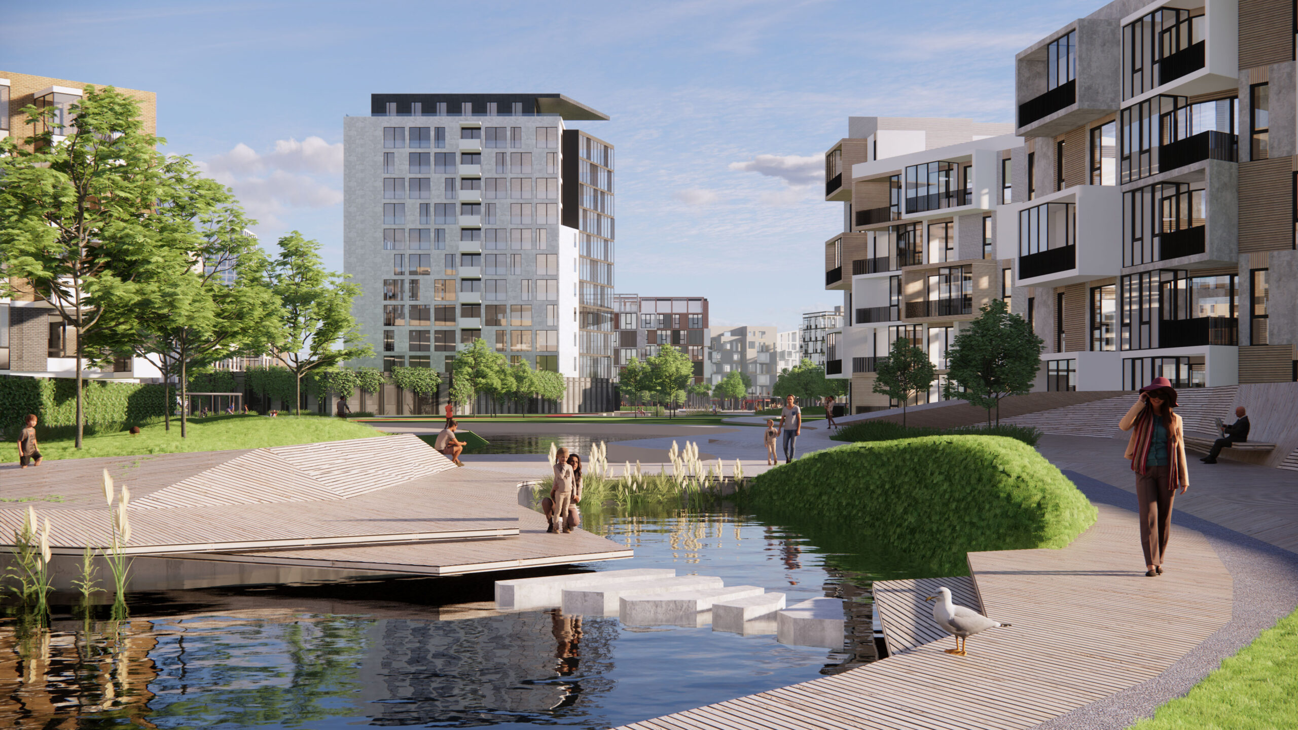
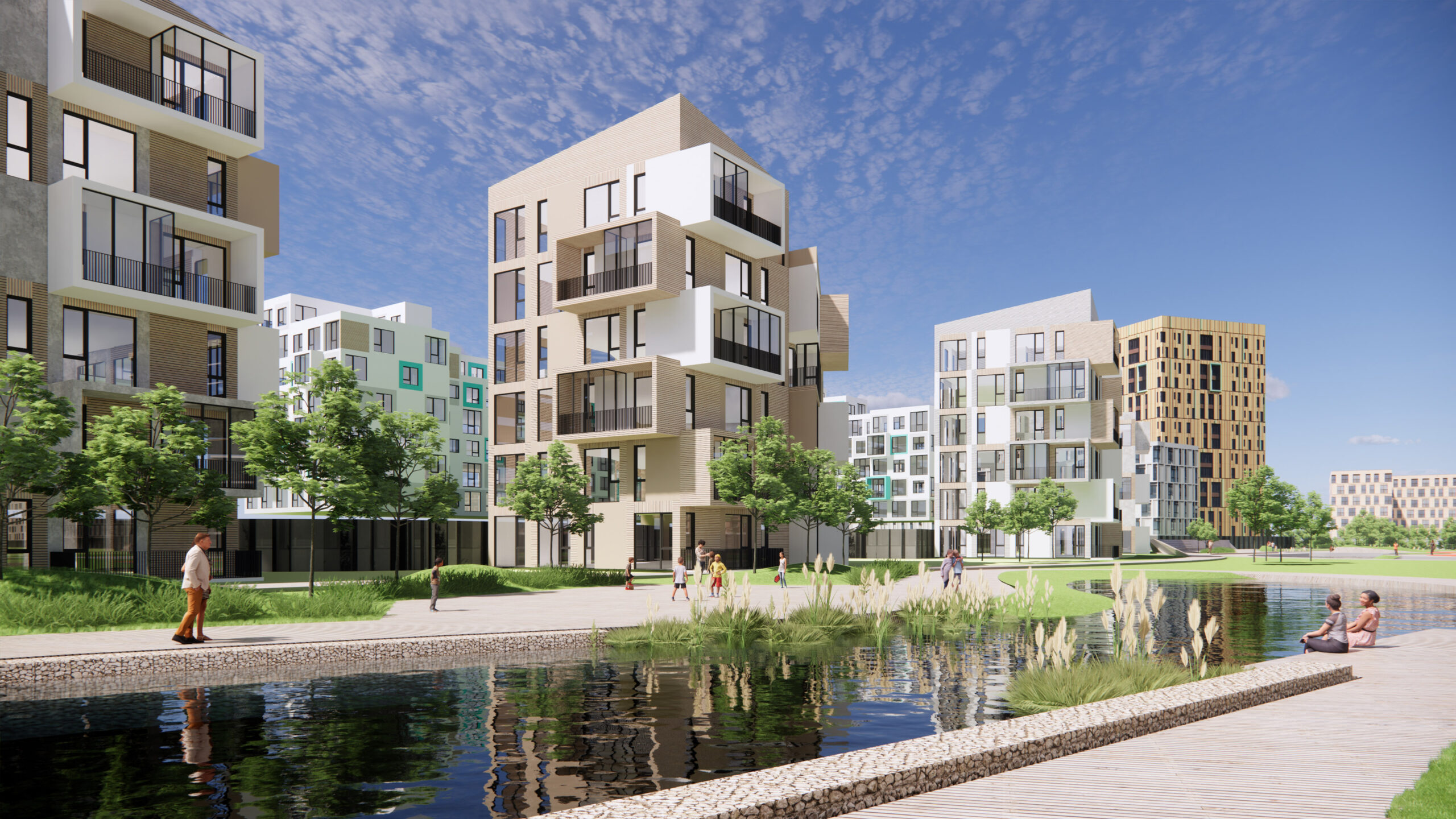
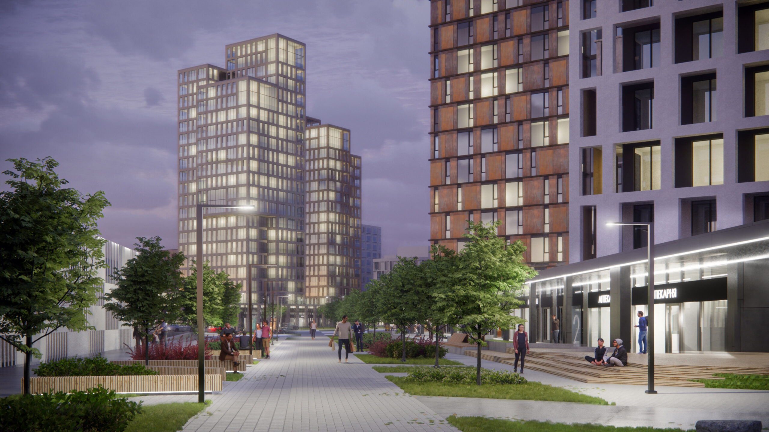
1*.The blocks are formed by perimeter housing and the urban villa development line, which repeats the smooth trajectory of the park and has direct access to it. Sections of houses have different heights within the same block — this forms an active silhouette of the development.
2*. A continuous green framework, which preserves the water bodies, continues the idea of eco-corridors designed by Kurokawa in the Nur-Sultan site plan.
3*. Different types of development create a unique look to the area and emphasize the hierarchy of spaces.
4*. School sites are connected to the development with pedestrian boulevards.
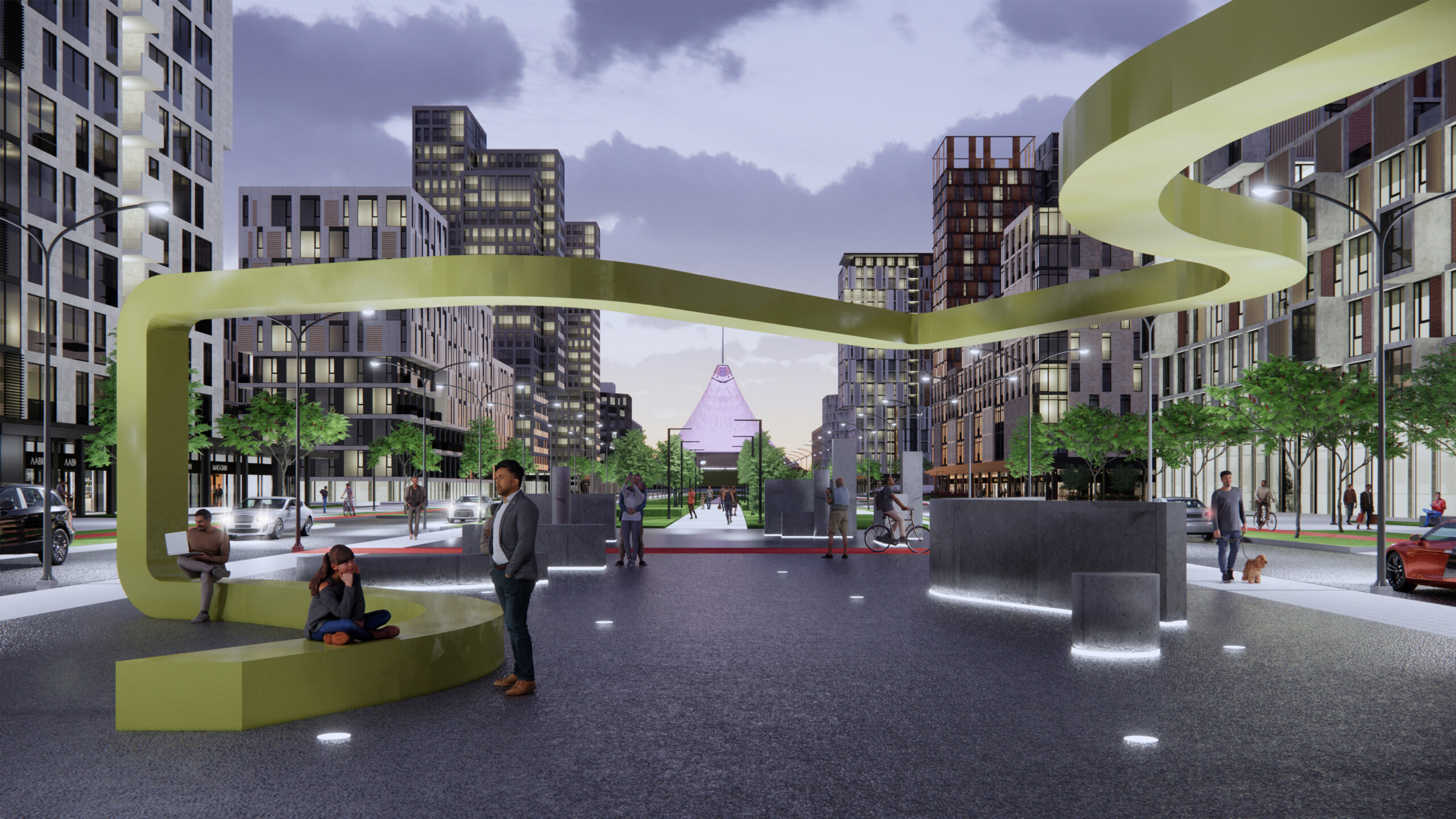
5*. Various types of public spaces are emphasized by architecture and landscaping. A natural pedestrian passway emerges among residential buildings. It is saturated with recreational and sports spaces and free from transport.
New principles of territory development
1. To integrate into the existing residential development and ensure connection with adjacent areas.
2. To preserve the existing natural landscapes, integrate them into the planning structure, and provide for the continuous green framework.
3. To create unique spaces and architectural ensembles that correspond to the primary compositional axis of the city.
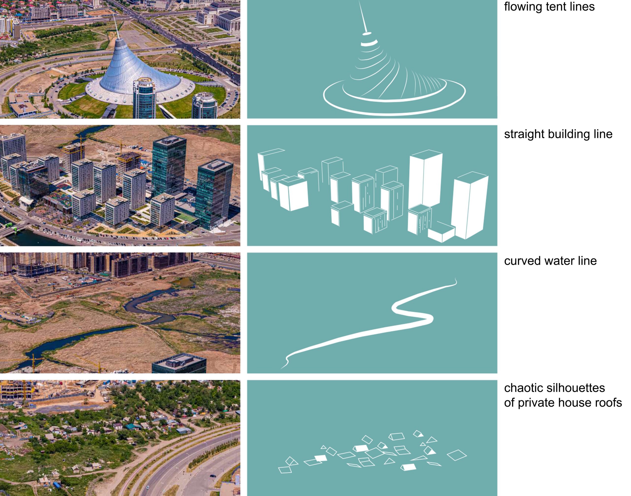
Our team based the visual image of the project on connecting the territory to the general context of the surrounding development: the smooth lines of the tent, the curved water line, the chaotic silhouettes of private houses’ roofs, and the straight lines of modern buildings.
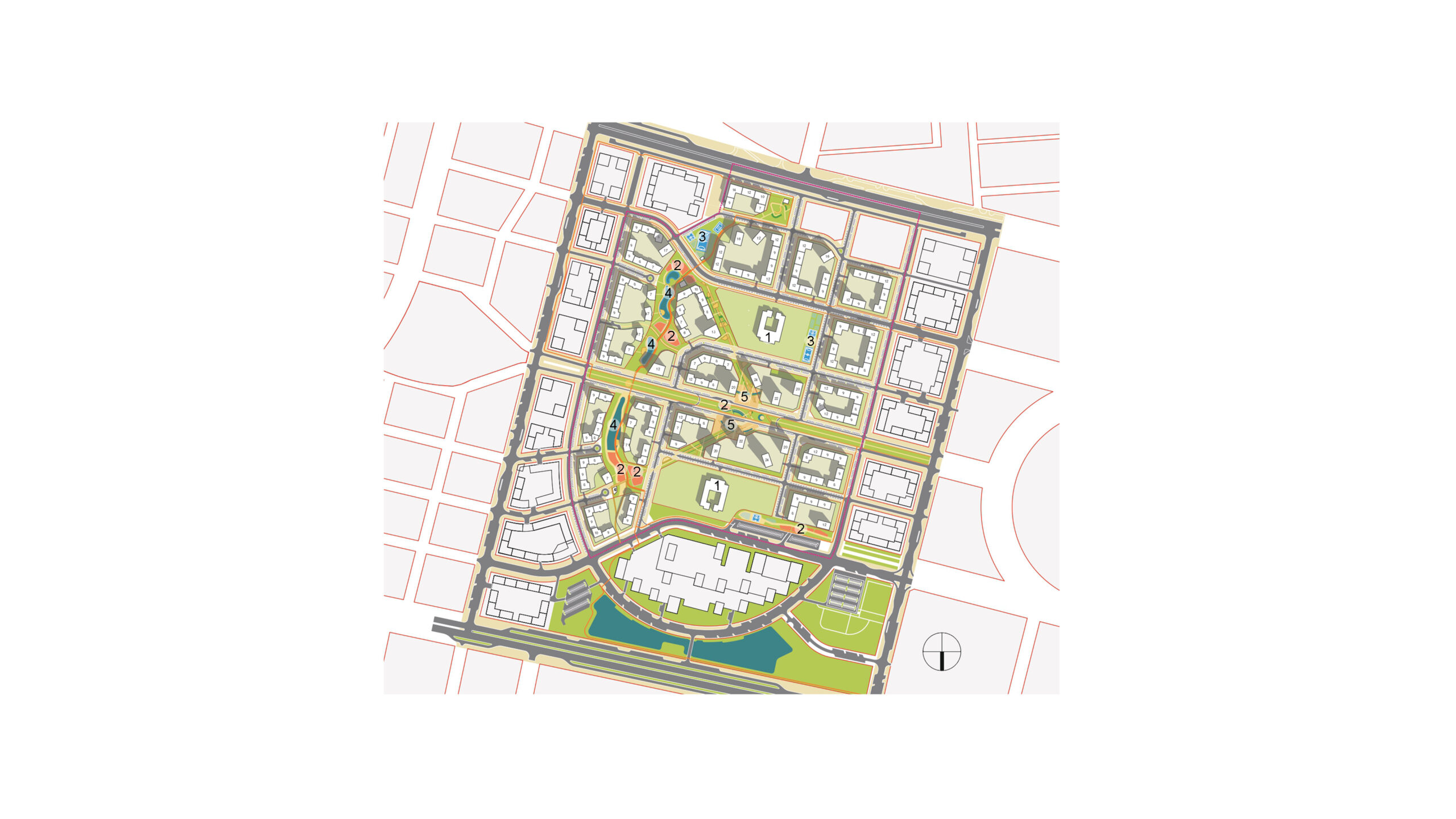
Social and public buildings and spaces
1. School
2. Playhub
3. Sports common spaces
4. Water landscape design facility
5. Central Square
The city’s site plan provides for multi-apartment residential buildings, schools, kindergartens, and recreational public spaces development in the design area.
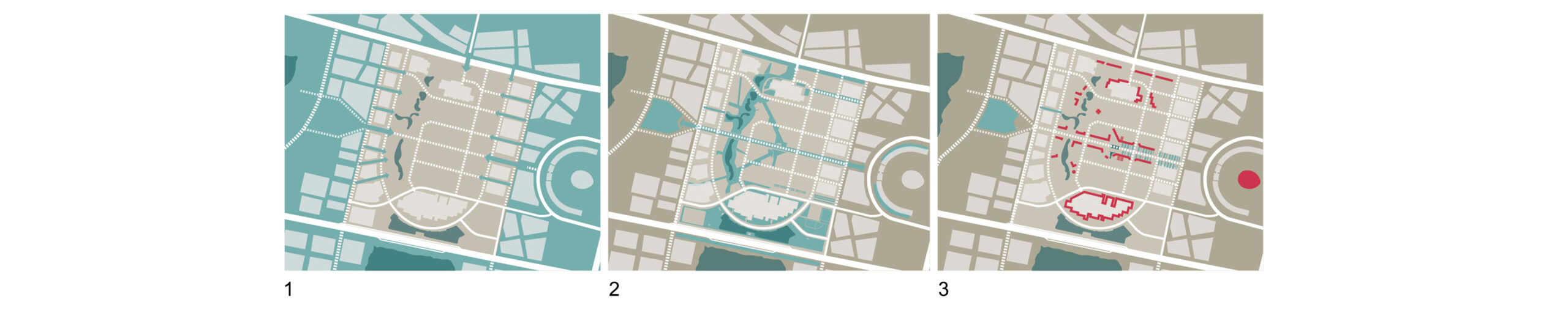
The compositional design of the detailed layout plan is based on the continuation of the citywide central axis. In our project, it becomes the main compositional axis of the district with the square in the central part.
Based on the existing water bodies, we proposed to create a second compositional axis in the form of a district park, which became a symbolic manifestation of the district name — GREEN LINE.
The district park will become a part of the system of continuous green zones of the natural framework of the city and will spatially connect the park with the street that led to the embankment of the Esil River.
Additional diagonal pedestrian boulevards will provide access for many residents to the park and schools and create subsidiary visual connections with the district center.
Central Boulevard and the WATER LINE Park will become the objects of attraction for all residents of the district and a hub of necessary recreational functions.